STREAM
Applying digital technologies to simplify the production of farmland habitat reports through an online application.
Concept
Environmental benchmarking of food systems is becoming an urgent requirement for farm-scale sustainability assessments. It is equally important to comply with international certification schemes, as it is a major contributor to the market reputation of food producers. Despite its importance, biodiversity is often absent from metrics for agricultural sustainability, This Flagship Innovation Experiment (FIE) uses technology to reduce the logistical effort and cost to produce customised farmland habitat reports for environmental assessments, which traditionally require specialised ecological expertise.
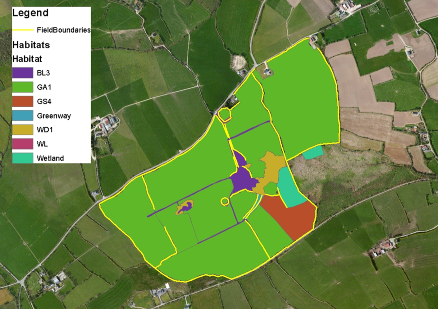
To provide a map of farmland habitats requires a smart combination of aerial imagery, existing Geographic Information System (GIS) data on biodiversity and, lastly, digitised land parcel information. The reliability of this FIE’s approach and modelled outputs were assessed by experts and on-the-ground surveys of farmland habitat, also known as ground-truthing.
The team developed an online application, linking photos of local habitats and wildlife features - provided by the farmer or advisor - with an information management system that collated land use information to produce reports for individual farms and demonstrate environmental assets and actions. The FIE also investigated the capacity of machine learning to improve habitat identification based on the visual interpretation of orthophotography.
Implementation
The first steps were to implement a database workflow to receive habitat information from the assessment of satellite imagery of farmland. The FIE successfully produced customized farmland habitat reports for each of the participating farms, including a farm map, a table with habitat areas, and selected images of habitat and wildlife (where provided from the farm) (mainly dairy and beef systems). The set of farms is part of the Teagasc National Farm Survey, and also part of the EU Farm Accountancy Data Network (FADN).
The second activity focused on conducting a preliminary investigation of the capacity of machine learning to improve habitat identification, based on the use of habitat images (from photos) from these 30 farms.
Walton Institute’s preliminary investigation showed that drone-based images can provide up to 70% accuracy on habitat classification, where this can be improved with further data covering all habitat types, which will be studied in future research
There were delays in fieldwork due to COVID-19 travel restrictions, which prevented farm visits until June 2021. This affected our visits to 30 farms, that were needed to collect detailed photos and drone imagery for 1) ground-truthing and knock-on effects on image input into 2) assisting machine learning of habitats using different image types. As mitigation, the collection of farm-scale photos was completed by FERS. b
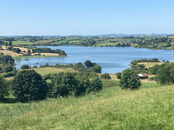
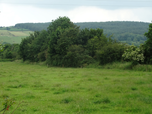
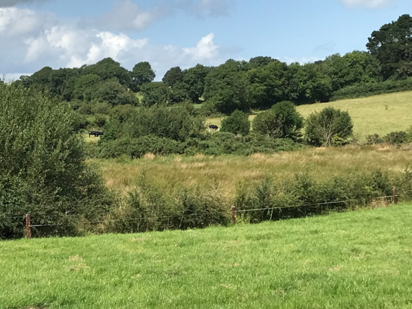
The development of the application to facilitate the download and transfer of farm photos has been significant. This helps provide tangible and realistic insight into the types of farms that we are dealing with and transforms a dry and text-heavy document into one that an individual farmer can relate to, and be proud of the biodiversity features on their farm.
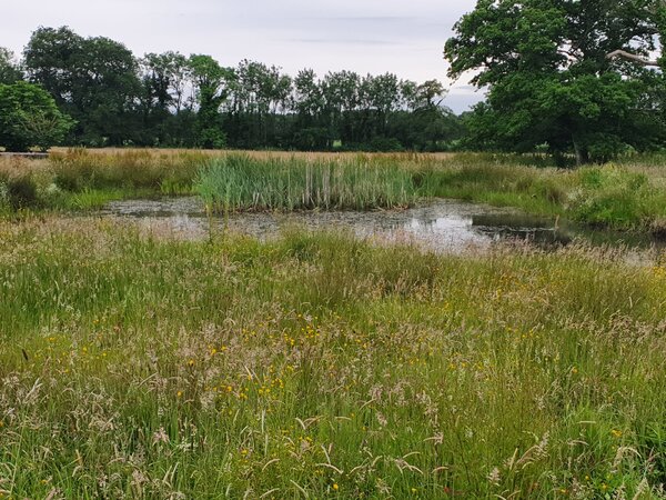
This solution is now market-ready. Participant farms are pictured below.
Lessons Learnt
There is a growing need for a service to allow farmers to interact with the generic, customised farm map and report, and include more tailored information on the location, activity and imagery of sustainable practices.
One of the lessons learnt during this project is that data requests from state agencies can take significantly longer than expected. This approach may be expected to be more cost-effective when the National Habitat Map of Ireland is available (includes approximately 1000 farms, to be available late 2021/ early 2022); this would reduce the need for the farm-by-farm assessment of habitat types from satellite imagery, as this would be already available from the National Habitat Map. With this national and public resource, there could be the widespread provision of farm-specific habitat maps.
The project has contributed to awareness within Teagasc, within the Department of Agriculture, Food and the Marine and among food companies that habitat mapping can be scaled and achievable at a much lower cost than what they envisaged.

Flagship Innovation Experiment
FIE# 2
Regional Cluster
Ireland & UK
Sector
Animal Production
Location
Ireland
Partners
member:
Walton Institute
member:
Teagasc
- Soils, Environment and Land Use
member:
Code Plus Ltd
member:
RC Ireland & UK
member:
South East Technological University
- Department of Land Science
Contact
Please log in to the Innovation Portal to see the contact details